
A pioneer in LiDAR services, Genesys offers a unique advanced mobile mapping system with high-resolution 360° panoramic imageries
Genesys can meet the accuracy standards required for creating maps, applications and solutions for a host of industries like Mining, Utilities and Urban Planning.
Genesys is a pioneer in providing Mobile Mapping Surveys in India and has the country’s largest fleet of mobile mapping units including a sizeable number of High Definition (LiDAR) scanning systems comprising Terrestrial, Backpack, Mobile and Aerial LiDAR scanners. We have developed a partnership with leading flying operators for airborne LiDAR surveys using fixed-wing / Unmanned Aerial Vehicles /helicopters.
lIdar services provide highly accurate data to develop -
Topographical Maps
3D Building Model
DTM/DSM
3D Flythrough
3D City Maps
Our in-house viewer application provides a ‘Real World’ experience by allowing viewing LiDAR Point Cloud Data augmented with 360-Degree Panoramic Imageries.


How LiDAR works?
Active Remote Sensing Technique
Collects Dense and Accurate Elevation Values
Uses Light Pulses (Laser Beams) instead of Radio Waves
How it works:
Laser scanners measure 3D points on the surface of the earth
A platform (tripod or vehicle mount) with a laser ranging system is moved around the relevant area
Lasers utilized emit millions of pulses per second
The travel time of these pulses is timed and recorded
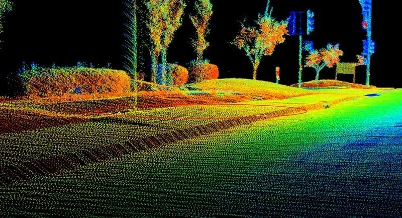
The X, Y, and Z measurements are displayed as a "point cloud“
Precise elevations are derived from the point cloud data
Can be viewed, measured and navigated as a 3D model
Provides incredible insight into the project site
In the case of terrestrial acquisition, the LiDAR system is typically mounted on a tripod or stationary device. At narrow/difficult places the system is carried on a backpack.
For mobile acquisition, the LiDAR system is mounted on a moving vehicle.
Airborne LiDAR system is installed in either a fixed-wing aircraft or helicopter. The laser light is emitted toward the ground and returned to the moving airborne LiDAR sensor.
Key Achievements
More than 75,000 linear km of road mapping in India
More than 3000 km of railroad corridor mapping
Over 250,000 linear km, spanning 65 major cities across India, of street-level 360-degree panoramic imagery data acquisition