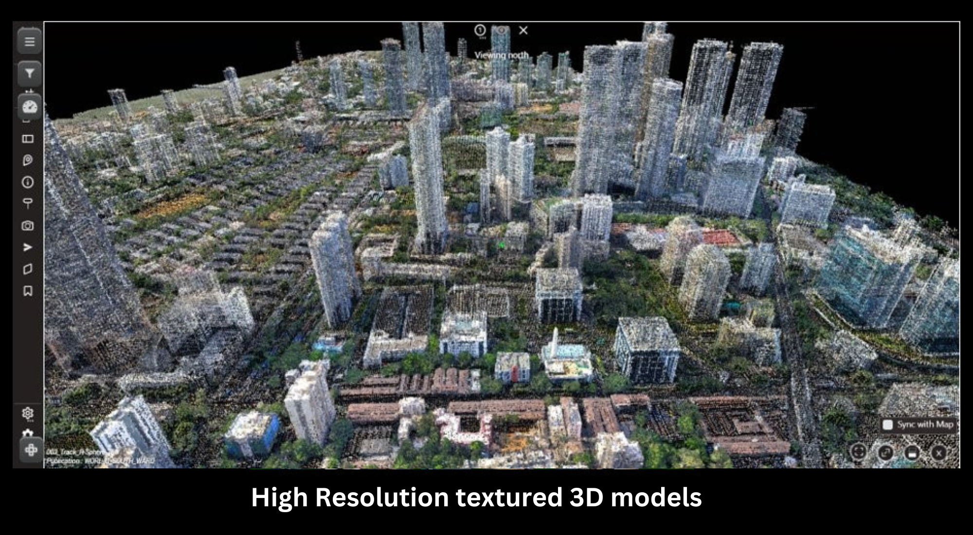

A high resolution and accurate 3D data sets are a pre-requisite for a variety of network planning purposes for Wireline and Wireless networks.
•The 5G networks require detailed geospatial information for network planning, identification, and inspection to detect issues and evaluate green coverage.

•3D Urban Spatial Digital Twins and their associated databases can be used to locate, identify, visualize, and inspect critical infrastructure such as roads, bridges, railway lines, hospitals, and public amenities.
•Using 3D data for mmWave network planning greatly helps operators avoid the challenges faced in 5G planning and deployment.
•Genesys 3D Content Program aims to capture and create realistic 3D Digital Twins of all major cities in India with high speed and accuracy using the Genesys Constellation sensor network.
•As part of our data services, Genesys creates 3D data-sets needed for Telecom service providers with high speed and accuracy.
•City-scale Digital Twins will enable government and private organizations to improve their performance, efficiency, and planning through the use of 3D data, making the process more efficient, effective, and sustainable.
3D data for 5G planning
A high resolution and accurate 3D data sets are a pre-requisite for a variety of network planning purposes for Wireless networks.

mmWave 5G RF Planning
FWA Planning
Microwave Back-haul Planning:
Terragraph Planning
SmallCell location
SmallCell backhaul Planning
And many more…
Benefits of using 3D data in planning phase:
Foresee obstructions and challenges in deployment.
Reduce commissioning time and costs.
Avoid costly mistakes and reworks in field
Reduce truck rolls and tower climbs.
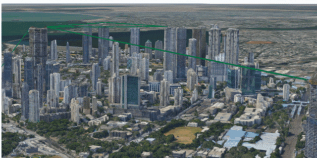
Use-case: Implementing LOS planning in dense urban area in Mumbai, India
Genesys implemented a case study to plan the LOS visibility for a variety of network technologies, in dense urban area of Mumbai, India to demonstrate the value that a high resolution 3D data set brings to wireless networks. Area includes a varied topography of high-rise, mid-rise and low-rise dense settlements.
Data Used:
True Ortho 5 cm
DSM 50 cm
3D mesh mode
Use-cases:
Microwave LOS qualification
Obstruction Detection
FSO LOS Qualification
Terragraph Planning
Genesys GIS Data Management services include creation and supply of wide range of high quality and updated spatial data sets to allow detailed and precise network planning and optimization tasks. Map data includes requisite details to allow wireless planners to improve predictions of signal attenuation, other radio propagation effects and assist in finding the optimal location of network base stations and other wireless system transmitters.
Our map data services also include a wide variety of data transformation services, including legacy data migration, integration and quality improvements.
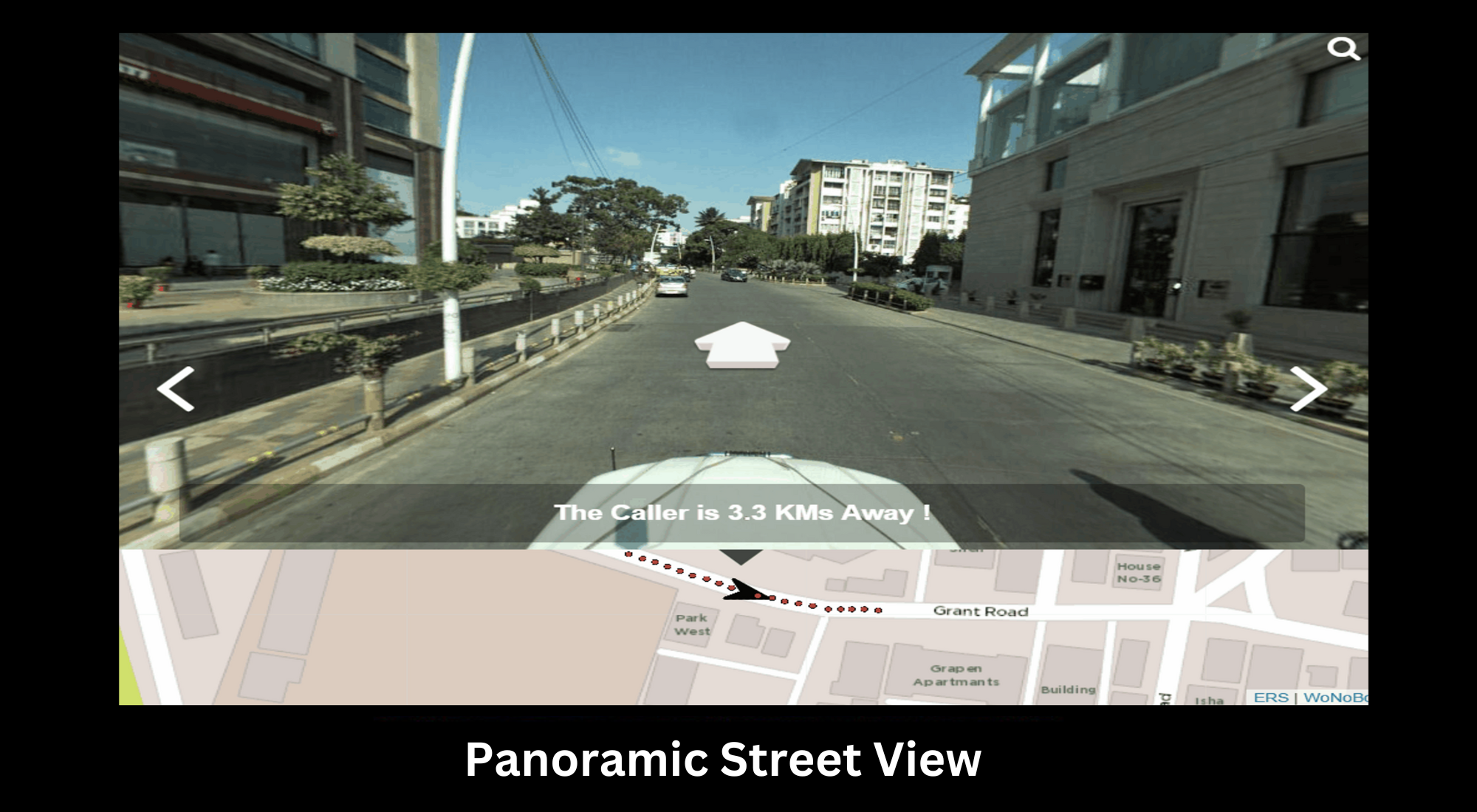
Street view Panaromic Imagery
High Resolution 3D maps
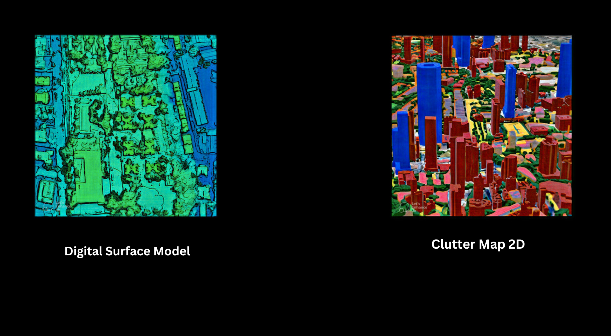
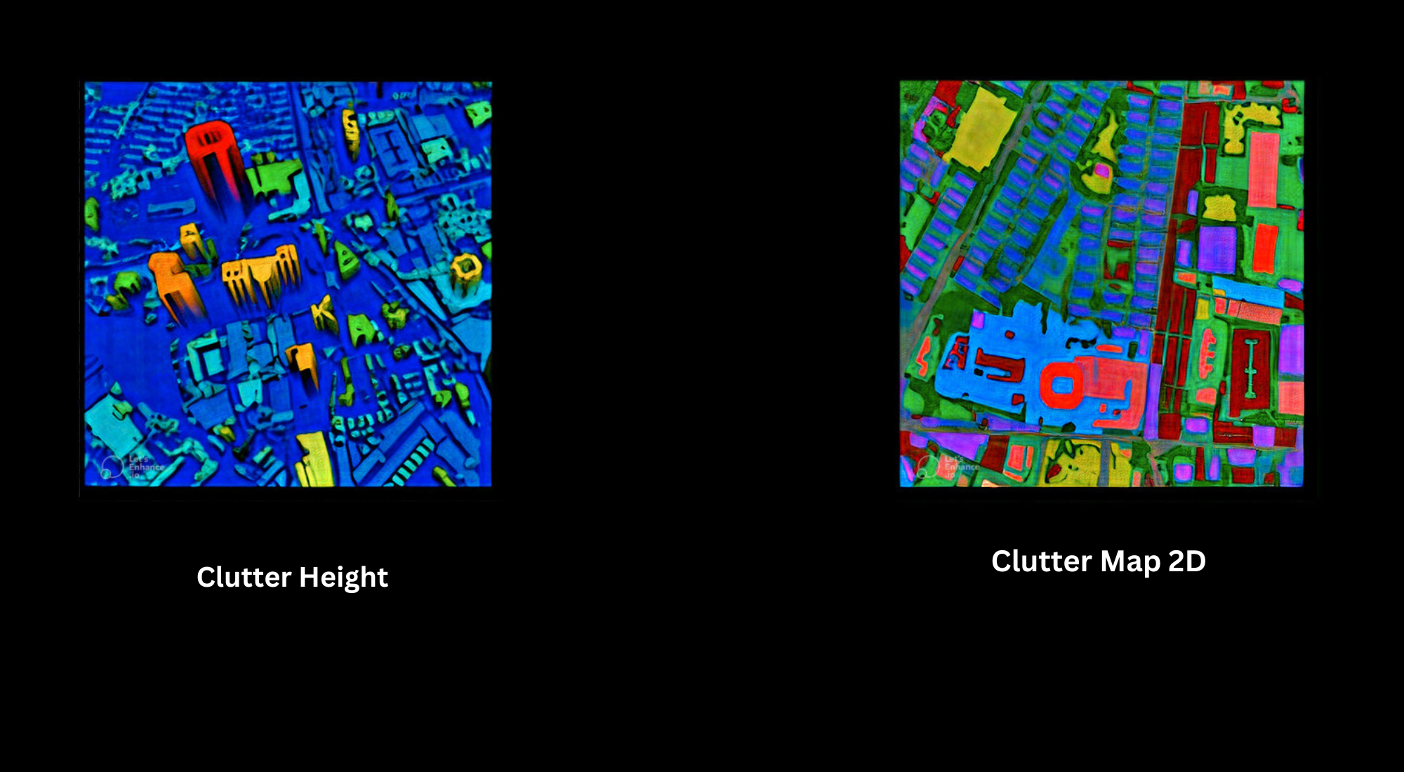
Clutter Maps
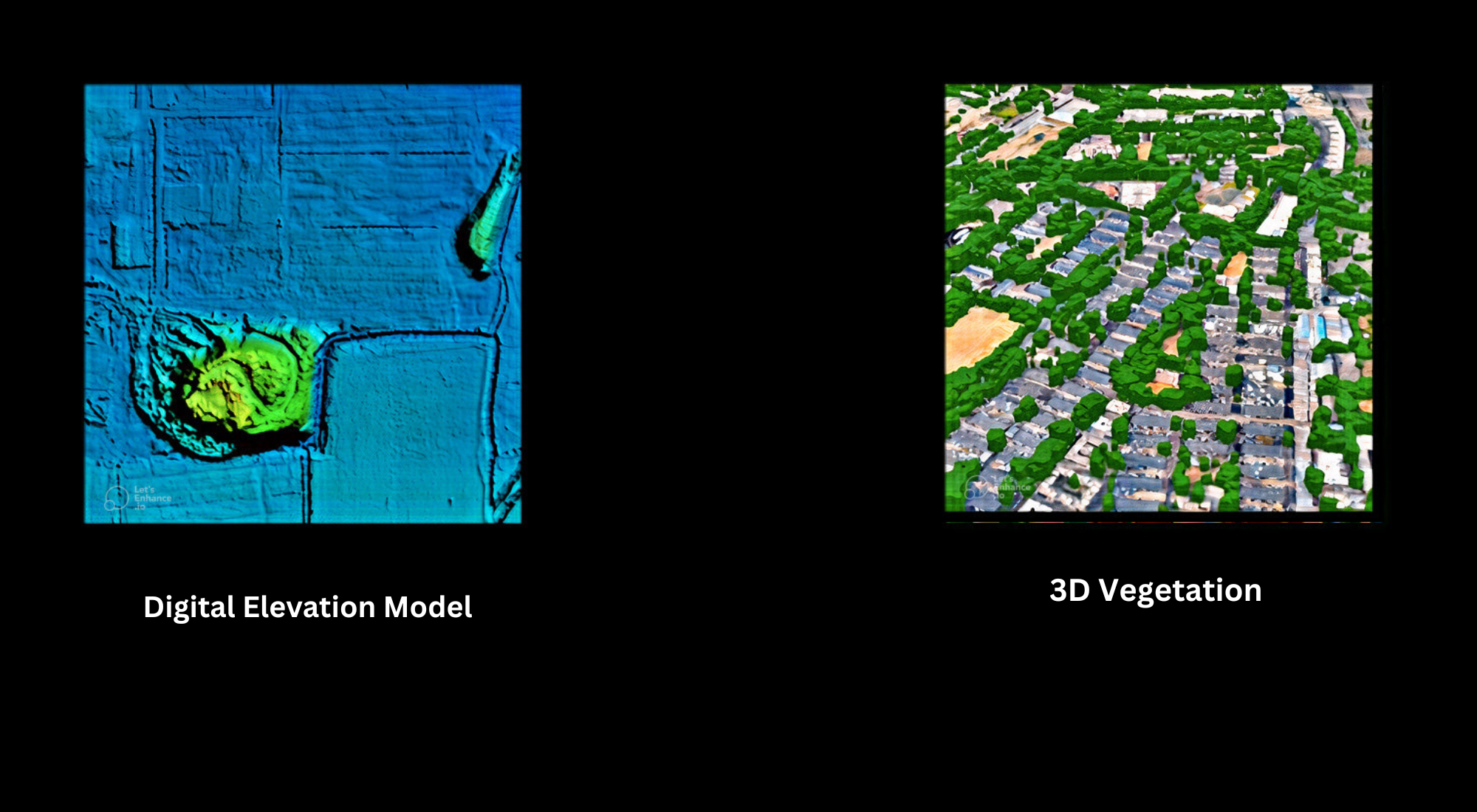
DTM, DSM, DEM
LiDAR Point Cloud
Satellite Imagery
Customised Map Services
Map Data Transformation Services